Dart Harbour and Navigation Authority do not provide a 24 hour 7 day a week service. River staff are contactable on channel 11 using call sign DARTNAV during working hours and the office are contactable on 01803 832337. There is a telephone number for urgent issues outside working hours and this is provided on the office answer machine.
Dart Harbour berths and facilities are well signposted and masters/skippers should take account of any restrictions when berthing. In particular, some berths may only be used with the Harbour Master’s express permission owing to the depth of water and bottom slope – but these are well marked.
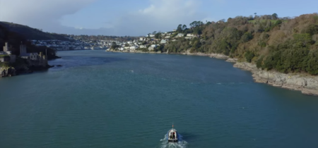
Masters/Skippers should familiarise themselves with the routes and locations of the crossing ferries which are marked on the chart, since they can be difficult to spot, particularly at high water when they berth at the top of their slipway. Particular care is required on entry with the lower ferry on the Kingswear side as this is out of sight when berthed and can surprise vessels on the starboard side of the channel. Likewise, the higher ferry can surprise vessels outboard on the starboard side of the channel when it leaves Dartmouth as it can be obscured by Dart Marina pontoons and vessels.
The two lower car ferries that ply between Kingswear and Dartmouth – comprise a tug and vehicle-carrying float that is towed alongside the tug – are assessed as “restricted in their ability to manoeuvre” by the MCA and exhibit appropriate shapes/lights.
The chain guided Higher Ferry that crosses the river just below Dart Marina exhibits the same shapes/lights. Beware of submerged wires in the vicinity of this ferry.
Local Notice to Mariners provide more information on current safety related issues.
The Dart Harbour sailing directions are linked here, (opens in a separate window) they are intended as a helpful description of your journey up river. They do not relieve masters and skippers of vessels of their obligation to conduct their own navigation and safe pilotage plans within harbour limits.
Note In the entrance, the stream ebb or flood seldom exceeds 2 knots except after heavy rainfall or strong northerly winds when, on the ebb tide, this can run up to 3.5 knots.
At spring tides, the river almost dries out for two miles below Totnes at low water, but vessels drawing not more than 0.9m (3 feet) can proceed to Totnes 1.5 hours after low water. The tidal stream 1.5 miles outside the entrance runs N.E. from 2 hours before to 4 hours after high water at Dartmouth and S.W. from 2 hours before to 4 hours after low water at Dartmouth.
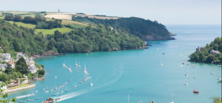
To make the best use of this guide, reference should be made to Admiralty Chart No 2253 (Edition No. 8. 3/12/2015) or a suitably detailed and up to date equivalent. Most Harbour Authority mooring buoys are blue. Those designated for visitors are white and marked with a black “V”. Visitors’ pontoons and visitors’ dinghy moorings are marked with blue flags and visitors signage. There are no formal visitors’ landing points south of the Lower Ferry.